This guide was last updated in June 2026. The American road trip is one of the great travel traditions, and planning one well makes the difference between a drive you remember forever and a week of fast food and highway fatigue. This guide covers iconic routes, planning tools, vehicle preparation, and budget strategies.
Why Planning a Road Trip Properly Matters
The romantic image of a road trip, windows down, music playing, open road ahead, is real. But the version that works is the one where someone has done the homework. Gas stations can be 80 miles apart on western routes. Small-town motels sell out during peak season. The difference between a road trip that feels effortless and one that feels like a chore comes down to planning. This guide covers choosing the right route, mapping stops, preparing your vehicle, and managing your budget.


Iconic American Road Trip Routes
These six routes represent the finest road trips in America, each offering a distinct experience, manageable driving distances, and reliable accommodations along the way.
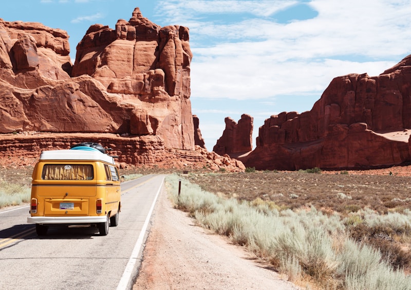
Pacific Coast Highway: San Francisco to Los Angeles
State Route 1 runs approximately 650 miles along the California coast. The most popular section, San Francisco to Los Angeles, covers about 380 miles. Plan five to seven days to properly appreciate the scenery and coastal towns.
Key stops heading south include Half Moon Bay for coastal bluffs, Monterey for the Aquarium and 17-Mile Drive through Pebble Beach, Big Sur for Bixby Creek Bridge, McWay Falls, and Pfeiffer Beach, Hearst Castle in San Simeon, Morro Bay for Morro Rock, and Santa Barbara before arriving in Los Angeles. Accommodations range from the Post Ranch Inn in Big Sur at $800/night to Cambria Pines Lodge at $130/night. September through November offers the best weather.
Route 66: Chicago to Santa Monica
Route 66, the Mother Road, stretches roughly 2,400 miles from Chicago to Santa Monica. While much of the original route has been replaced by Interstate 40, significant sections remain driveable. A full trip takes two to three weeks. For a shorter experience, the Arizona and New Mexico section from Albuquerque to Los Angeles covers about 800 miles in five to seven days.
Essential stops include the Gemini Giant in Wilmington, Illinois, the Gateway Arch in St. Louis, Cadillac Ranch in Amarillo, Tucumcari's neon-signed motels in New Mexico, the Oatman Hotel in Arizona where wild burros roam the streets, and the Santa Monica Pier where the route officially ends. Use the Route 66 Navigation app to map the historic alignment and flag surviving businesses.
Blue Ridge Parkway: Virginia to North Carolina
The Blue Ridge Parkway runs 469 miles along the Blue Ridge Mountains crest from Shenandoah National Park to Great Smoky Mountains National Park. The parkway has a strict 45 mph speed limit, no commercial traffic, and no stoplights, creating a journey-focused experience. Plan five to seven days for the full route.
Key stops include Humpback Rocks at Milepost 5.8, the Peaks of Otter at Milepost 86, Mabry Mill at Milepost 176, Doughton Park at Milepost 238 for hiking, Linville Falls at Milepost 316, Mount Mitchell at Milepost 355, the highest point east of the Mississippi, and Cades Cove near Great Smoky Mountains. Lodging is limited along the parkway, so most travelers stay in Roanoke, Boone, or Asheville. Mid-September through October offers spectacular fall foliage.
Great River Road: Minnesota to Louisiana
The Great River Road follows the Mississippi from Lake Itasca, Minnesota, to the Gulf of Mexico, about 3,000 miles across ten states. For a manageable trip of seven to ten days, the middle section from Galena, Illinois, through Missouri, Arkansas, and Mississippi to New Orleans covers about 1,200 miles.
Notable stops include Galena, Illinois, for its 19th-century architecture, Hannibal, Missouri, Mark Twain's boyhood home, Memphis for Graceland and Beale Street, Vicksburg for the Civil War battlefield, Natchez for antebellum mansion tours, and New Orleans for the French Quarter. The route is driveable year-round, but spring and fall offer the most comfortable temperatures.
Overseas Highway: Miami to Key West
US Route 1 stretches 113 miles from Miami to Key West across 42 bridges over turquoise water. The most dramatic section is the Seven Mile Bridge between Marathon and Big Pine Key. The drive takes about four hours, but plan two to three days to experience the Keys.
Key stops include John Pennekamp Coral Reef State Park in Key Largo for snorkeling, Robbie's Marina in Islamorada for feeding tarpon, Marathon for Sombrero Beach and the Turtle Hospital, Bahia Honda State Park for the best beach in the Keys, and Key West for Mallory Square sunset, Duval Street, and the Hemingway Home. Winter, December through April, is peak season with the best weather.
Going-to-the-Sun Road: Glacier National Park, Montana
Going-to-the-Sun Road is a 50-mile scenic drive through Glacier National Park that crosses the Continental Divide at Logan Pass, elevation 6,646 feet. The road climbs through alpine meadows, past glacial lakes, and along sheer cliff faces with some of the most dramatic mountain scenery in the lower 48 states. The road is open only from late June through October and requires a vehicle reservation during peak season.
Plan a full day with stops at Lake McDonald Lodge, Avalanche Creek Trail for a two-mile hike through a cedar-hemlock forest to a waterfall, Logan Pass Visitor Center for the Highline Trail, one of the best day hikes in the park system, and Many Glacier Hotel for lunch. The road takes three hours without stops but budget seven to ten hours to properly experience the trailheads and viewpoints.
Planning Tools and Apps for Road Trips
Technology has transformed road trip planning. These tools help you map routes, find stops, calculate costs, and navigate with confidence on the road.
Route Planning Tools
Google Maps remains the most versatile tool for route planning. Enter your starting and ending points, then drag the route to add waypoints for stops. The tool calculates total driving time, distance, and estimated fuel costs. For more advanced road trip planning, Roadtrippers.com allows you to build a route with up to 150 stops, discover attractions, restaurants, and lodging along your route, and calculate fuel costs based on your vehicle. The premium version at $36 per year includes offline maps, which are essential for routes through areas with limited cell service like Big Sur, the Utah canyonlands, and the western Great Plains.
Navigation on the Road
Google Maps and Waze are standard navigation apps but require cell connection. For offline navigation in remote areas, download the areas in Google Maps before departure or use the Maps.me app as backup. RV and large-vehicle drivers should use the CoPilot app for route planning that accounts for vehicle size, height, and weight restrictions on mountain and forest service roads.
Finding Stops and Attractions
Atlas Obscura is the best resource for unusual stops not in standard travel guides, cataloging over 20,000 places from roadside attractions to natural wonders. Roadside America maintains a database of quirky attractions by state and route. For camping, the iOverlander app lists public campgrounds, dispersed camping, and water sources along any route.
Calculating Drive Times with Realistic Stops
The most common planning mistake is using Google Maps' estimated driving time as your actual travel time. Google Maps assumes you will drive at or near the speed limit with minimal stops. In practice, plan for your actual road trip time to be 25 to 40 percent longer than the navigation estimate. A Google Maps estimate of five hours means you should plan for six and a half to seven hours of actual travel including gas stops, bathroom breaks, meals, and the spontaneous stops that make road trips worthwhile.
A practical formula: add 15 minutes for every two hours of driving for gas and bathroom stops. Add 30 to 45 minutes for meals and 30 minutes for each planned attraction. Add 15 percent for traffic and construction. For a 400-mile day with three attraction stops and one meal: seven hours base driving, plus 45 minutes for gas and rest stops, 45 minutes for meals, 90 minutes for attractions, and one hour buffer, totaling about 10.5 hours.
Budget Planning for Road Trips
A road trip budget breaks down into five categories: fuel, lodging, food, activities, and vehicle maintenance. Fuel is the most predictable cost. Calculate total miles, divide by your vehicle's miles-per-gallon rating, and multiply by the average fuel price along your route. GasBuddy.com provides real-time fuel prices by state and city. For a 2,000-mile road trip in a vehicle that gets 25 miles per gallon at $3.50 per gallon, your total fuel cost is $280.
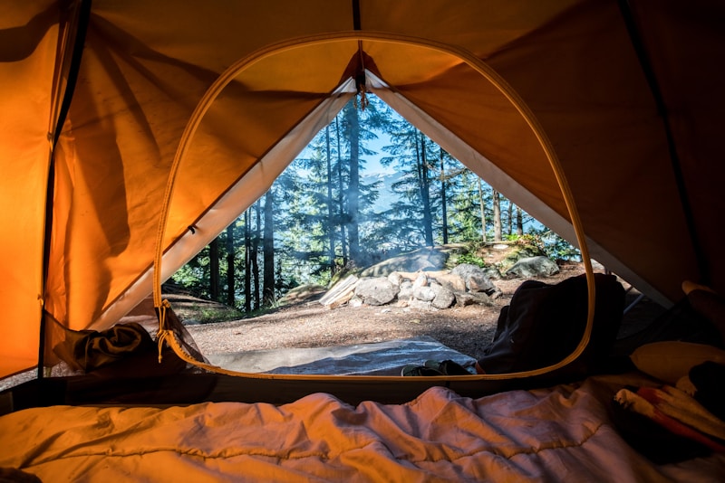
Lodging is the largest variable. Budget motels like Motel 6, Super 8, and Days Inn cost $60 to $100 per night. Mid-range options like Hampton Inn and Holiday Inn Express run $120 to $180 per night. Boutique hotels and unique properties can range from $150 to $400 per night. For budget-conscious travelers, camping at state and national parks costs $20 to $35 per night. Food on the road costs $40 to $60 per person per day if you eat at restaurants for most meals, or $20 to $30 per person per day if you prepare some meals from grocery store provisions and eat at restaurants once daily. Activities vary enormously, but budget $20 to $50 per person per day for attractions, park entry fees, and guided experiences.
Vehicle Preparation Before a Road Trip
A breakdown in the middle of a road trip is not just inconvenient; it can be dangerous and expensive, especially in remote areas. Taking your vehicle to a mechanic for a pre-trip inspection is one of the smartest investments you can make. Have them check the oil level and condition, coolant level, brake pads and rotors, tire tread depth and pressure, battery health, and all fluid levels. Replace any belt or hose that shows cracking or wear. If your vehicle is due for an oil change, timing belt replacement, or brake service, have it done before the trip, not during it.
Carry a roadside emergency kit that includes jumper cables, a tire pressure gauge, a spare tire in good condition, a jack and lug wrench, a basic tool kit with screwdrivers, pliers, and an adjustable wrench, two gallons of water, a first aid kit, a flashlight with extra batteries, and a blanket. In summer, add sunscreen and extra water. In winter, add an ice scraper, sand or cat litter for traction, and warm clothing. For desert and mountain routes, a satellite communicator like the Garmin inReach can send SOS signals from areas with no cell coverage and costs $350 to $450, with subscription plans starting at $15 per month.
Common Mistakes Road Trip Planners Make
Overestimating Daily Driving Distance
Driving 500 miles in a day is possible but exhausting, and doing it multiple days in a row kills the enjoyment of the trip. A sustainable road trip pace is 250 to 350 miles per day, which leaves time for meaningful stops and a reasonable arrival time. If your route requires longer driving days, plan a rest day every three to four days where you do not drive at all or cover fewer than 100 miles. The goal is to arrive at your destination ready to explore, not too tired to leave the hotel room.
Ignoring Seasonal Road Closures
Many of the most scenic roads in America close seasonally. Going-to-the-Sun Road in Glacier National Park is open only from late June through October. The Tioga Pass in Yosemite closes from November through May. Trail Ridge Road in Rocky Mountain National Park closes from October through May. Check the National Park Service website and state DOT websites for current road conditions before you depart. Planning a road trip around a seasonal road that is closed when you arrive is a costly and frustrating mistake.
Not Booking Accommodation in Advance
In popular destinations like Yellowstone, the Florida Keys, and Big Sur, accommodations book out weeks or months in advance during peak season. Driving into a town at 7 PM without a reservation and hoping to find a room is a gamble that rarely pays off during summer. Book your lodging at least two weeks in advance, earlier for peak season and popular areas. For flexibility, book accommodations that offer free cancellation so you can adjust if your pace changes.
Conclusion: The Road Trip Is About the Space Between
A great road trip is defined not by the destination but by the hours between destinations. The conversations, the songs, the unexpected diner that serves the best pie you have ever eaten, the roadside attraction that is gloriously absurd, the sunrise over a landscape you have never seen before. These moments happen because you gave yourself the time and freedom to find them. Plan the route, prepare the vehicle, budget honestly, and then let the road do what the road does best: surprise you. America was built for road trips, and a well-planned one delivers the kind of experience that stays with you long after you have parked the car and unpacked the bags.
Ready to Map Your Perfect Road Trip?
Discover curated travel routes and road trip experiences on Travlike
Explore Routes